Mastering Reclamation and Reporting in Utah’s Uinta Basin

Mastering Reclamation and Reporting in Utah’s Uinta Basin: Essential Practices for Oil and Gas Operators
The Uinta Basin is known for its oil and gas production, yet operators in this region face increasingly complex regulatory demands around land reclamation, data capture, Geospatial, and reporting requirements. These challenges stem from heightened environmental standards set by organizations such as the Bureau of Land Management BLM and Utah Division of Oil Gas and Mining DOGM.
This article explores key aspects of reclamation and environmental data requirements in the Uinta Basin, offering practical steps to help companies remain compliant and implement best practices in environmental management.

Understanding Reclamation Requirements in the Uinta Basin
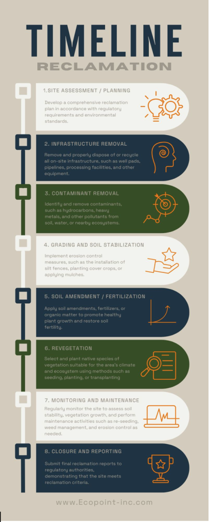
Land reclamation has become a cornerstone of compliance for operators in the Uinta Basin. Regulations from the Bureau of Land Management BLM and Utah Division of Oil Gas and Mining DOGM require operators to restore disturbed sites to their natural condition after project completion. This mandate extends beyond site closures to include long-term monitoring and detailed reporting, ensuring the land can return to its original ecosystem functions.
Key Reclamation Standards:
- Site Rehabilitation: Includes stabilizing soil, managing erosion, and replanting native vegetation.
- Long-Term Monitoring: Requires periodic assessments to ensure restoration success over time.
- GIS-Based Reporting: Operators must utilize GIS and remote sensing to capture data on reclamation progress and environmental impact.
These standards require that reclamation be considered not as an afterthought, but as an integral part of operational planning. For additional resources and information please read our article on Navigating the Evolving Regulatory Landscape in Utah’s Uinta Basin: A Guide for Oil and Gas Operators.
Data Capture and Reporting Requirements
Data capture and reporting are now essential components of compliance for reclamation in the Uinta Basin. The Bureau of Land Management BLM and Utah Division of Oil Gas and Mining DOGM latest standards emphasize the use of advanced technology, including GIS mapping and data-driven reporting, to document progress and ensure accountability.
1. Detailed Data Capture and Reporting Standards
- Requirement: Compliance requires that all reclamation and site health data, from soil stability to vegetation growth, be collected at regular intervals and stored in a retrievable format.
- Reporting Protocols: The Bureau of Land Management BLM and Utah Division of Oil Gas and Mining DOGM mandate specific metrics and intervals for data collection, often including quarterly or annual reports on reclamation progress. These reports must include:
- Soil Composition and Erosion Data
- Vegetation Coverage and Diversity
- Water Quality Measurements (for sites near water sources)
Capturing detailed data ensures that reclamation is both effective and sustainable, while regular reporting fosters transparency and allows regulators to track the health of reclaimed sites.
2. Leveraging Technology for Efficient Reclamation Reporting
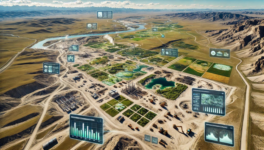
Advanced technology, particularly GIS and drone imaging, offers significant advantages for reclamation reporting. High-resolution imaging and real-time data collection can accurately reflect site conditions and reclamation progress, allowing companies to demonstrate compliance and adapt reclamation efforts as needed.
- Drone Surveillance and Data Capture: Drones can monitor hard-to-reach areas and produce real-time images, capturing details like soil health and vegetation cover with precision.
- Satellite and GIS Monitoring: GIS tools allow for the overlay of historical data with current site images, helping operators track changes in land condition over time.
By embracing these technologies, operators can create comprehensive reports that meet the Bureau of Land Management BLM and Utah Division of Oil Gas and Mining DOGM standards, enhance reclamation outcomes, and reduce potential penalties for non-compliance.
Challenges in Reclamation Compliance
For oil and gas operators, meeting the Bureau of Land Management BLM and Utah Division of Oil Gas and Mining DOGM stringent reclamation standards in the Uinta Basin can be challenging due to several factors:
- High Costs: Advanced data collection and regular reporting require investment in technology and personnel, especially for GIS and drone equipment.
- Technical Expertise: Proper use of GIS and remote sensing demands specialized knowledge, often requiring operators to work with environmental consultants who understand both the technology and regulatory requirements.
- Ecosystem Sensitivity: The Uinta Basin’s unique ecology means that reclamation efforts must account for native species and fragile soils, adding complexity to both the reclamation process and compliance reporting.
Best Practices for Effective Reclamation and Reporting
To overcome these challenges and ensure compliance, operators in the Uinta Basin can adopt the following best practices:
1. Develop a Comprehensive Reclamation Plan from the Outset
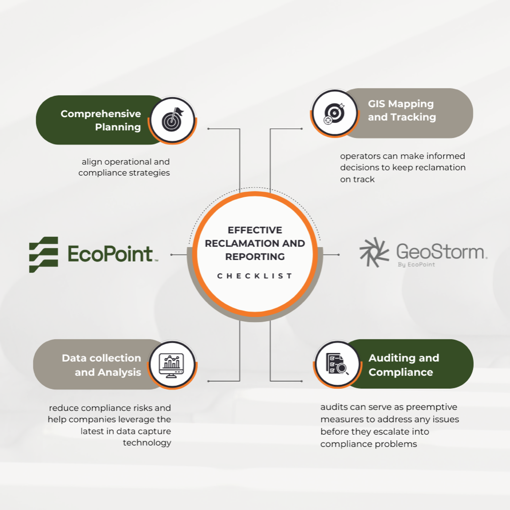
- By integrating reclamation as part of initial project planning, companies can align their operational and compliance strategies. This proactive approach helps avoid costly changes down the line and improves long-term site sustainability.
2. Utilize GIS Mapping to Track Reclamation Progress
- GIS mapping enables operators to visualize site conditions, monitor progress, and adjust reclamation efforts based on real-time data. By tracking reclamation changes over time, operators can make informed decisions to keep reclamation on track.
3. Conduct Regular Environmental Audits
- Environmental audits provide critical checkpoints for ensuring that data is being collected accurately and that reclamation is meeting the Bureau of Land Management BLM and Utah Division of Oil Gas and Mining DOGM standards. Audits can also serve as preemptive measures to address any issues before they escalate into compliance problems.
4. Partner with Environmental Consultants for Data Collection and Analysis
- Partnering with environmental consultants who specialize in the Uinta Basin’s regulatory requirements can reduce compliance risks and help companies leverage the latest in data capture technology, GIS, and reporting methods.
Conclusion: Embracing Technology for Sustainable Reclamation in the Uinta Basin
Adhering to Utah’s evolving reclamation and reporting standards is essential for oil and gas operators in the Uinta Basin. With the right combination of technology, expertise, and strategic planning, companies can meet the Bureau of Land Management BLM and Utah Division of Oil Gas and Mining DOGM rigorous requirements while also promoting sustainable land use.
By investing in GIS mapping, drone technology, and comprehensive data capture, operators can achieve successful reclamation outcomes that benefit both their operations and the environment. EcoPoint offers customized solutions to support these efforts, from GIS and monitoring to compliance reporting, helping operators navigate the complexities of reclamation with confidence.
Ready to enhance your reclamation practices? Schedule a call today with one of our industry experts.